Boleyn Ground


Boleyn Ground
Boleyn Ground
Google Maps Google Maps Live Maps Live Maps Yahoo Maps Yahoo Maps
By: stuartwr @ 2005-06-21 11:58:19
Description: 
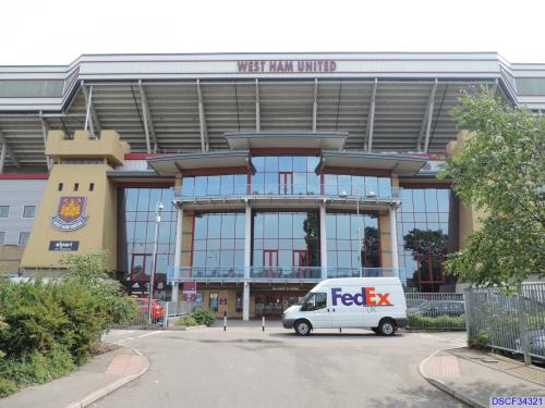
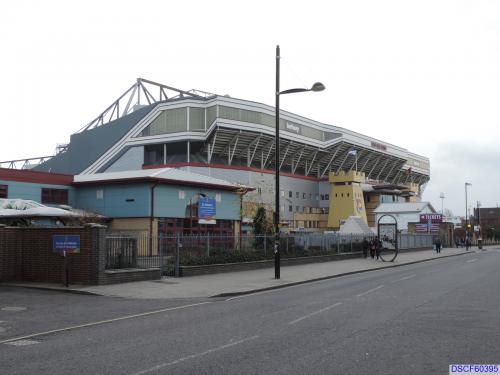
West Ham United Football Club
The home of the mighty Hammers.
More Info: en.wikipedia.org
Location: London, United Kingdom (GB)
@ 51.53225200, 0.03869900
Views: 243
Rating: Rate as 1 Rate as 2 Rate as 3 Rate as 4 Rate as 5 Rate as 6 Rate as 7 Rate as 8 Rate as 9 Rate as 10 6.6 (11 votes)

Categories

Download

Tell
Share
Update Imagery

Nearby Maps (50 km): (731)
  1. Newham Town Hall (1.2km)
  2. Sunken fishing boat (2.6km)
  3. Abbey Mills Pumping Station (2.8km)
  4. ExCeL Exhibition Centre (2.8km)
  5. Sunborn Yacht Hotel (2.8km)
  6. Steam Locomotive 'Robert' (3km)
  7. Workers' Memorial (3.1km)
  8. Abandoned bridge / new bridge (3.2km)
  9. London City Airport (LCY) (3.2km)
  10. Dudley Inkwell Group (3.3km)
721 more...


Comments

RSS: Comments RSS: Comments

kjfitz @ 2006-02-13 21:53:24
kjfitz's picture In the newest images there is earthmoving equipment stripping the sod from the field.

Post a Comment: (Policies)

Please log in if you don't want to post anonymously (anonymous users cannot post links)

Name: Anonymous
Comment:
Anti-Spam Code: Please enter the code below:
Please enable images and enter code to post
Pre-Caching Vote image