Cedarburg Covered Bridge


Cedarburg Covered Bridge
Google Maps Google Maps Birds Eye Birds Eye Yahoo Maps Yahoo Maps
By: milwhcky @ 2007-03-19 11:15:22
Description: 
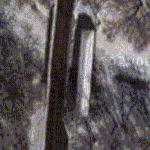
The last remaining covered bridge in Wisconsin. It was built in 1876 and was retired in 1962. It crosses Cedar Creek.
More Info: www.co.ozaukee.wi.us
Location: Cedarburg, Wisconsin (WI), United States (US)
@ 43.33780800, -88.00515200
Views: 221
Rating: Rate as 1 Rate as 2 Rate as 3 Rate as 4 Rate as 5 Rate as 6 Rate as 7 Rate as 8 Rate as 9 Rate as 10 Unrated

Categories

Download

Tell
Share
Update Imagery

Nearby Maps (50 km): (180)

168 more...


Post a Comment: (Policies)

Please log in if you don't want to post anonymously (anonymous users cannot post links)

Name: Anonymous
Comment:
Anti-Spam Code: Please enter the code below:
Please enable images and enter code to post