Enchanted Rock

Enchanted Rock (Google Maps)
No Thumbnail
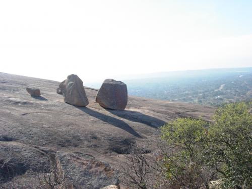
Enchanted Rock is a pink granite mountain in the Llano Uplift about 27 km north of Fredericksburg. Enchanted Rock State Natural Area, which includes Enchanted Rock and the surrounding land, spans the border between Gillespie and Llano counties, south of the Llano River. Enchanted Rock covers about 640 ac and rises around 130 m above the surrounding terrain to an elevation of 556 m above sea level. It's the largest pink granite monadnock in the country. In 1936, the area was designated a Recorded Texas Historic Landmark. In 1971, it was designated a National Natural Landmark by the NPS. The Enchanted Rock Archeological District
was added to the NRHP on 8/29/84.

Enchanted Rock was rated in 2017 as the best campsite in Texas in a 50-state survey.[7]
1,404 views
Views by date
6.0 (15 votes)
Rate as 1Rate as 2Rate as 3Rate as 4Rate as 5Rate as 6Rate as 7Rate as 8Rate as 9Rate as 10

Categories

Comments

Policies

Please log in if you don't want to post anonymously (anonymous users cannot post links).

Note: VirtualGlobetrotting is an entertainment website is and is not associated with this post, location or person.

Please enable images and enter code to post
Reload

Around the World Mailing List

Pics: 5
Enchanted Rock : WacoKidd110's pic
Share:

Comments

Policies

Please log in if you don't want to post anonymously (anonymous users cannot post links).

Note: VirtualGlobetrotting is an entertainment website is and is not associated with this post, location or person.

Please enable images and enter code to post
Reload