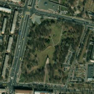
Babyn Yar (Ukrainian: Бабин Яр, Babyn Yar; Russian: Бабий Яр, Babiy Yar) is a ravine in Kiev, the capital of Ukraine. It is located at the juncture of today's Kurenivka, Lukianivka and Syrets raions, between Frunze, Melnykov and Olena Teliha streets and St. Cyril's Monastery.
In the course of two days, September 29-30, 1941, a special team of German SS troops supported by other German units, local collaborators and Ukrainian police murdered 33,771 Jewish civilians after taking them to the ravine. The Babyn Yar massacre was the largest single mass killing for which the Nazi regime and its collaborators were responsible during its campaign against the Soviet Union and is considered to be "the largest single massacre in the history of the Holocaust".
In the months that followed, thousands more were seized and taken to Babyn Yar where they were shot. It is estimated that more than 100,000 local people, mostly civilians, of whom a significant number were Jews, were murdered by the Nazis there during World War II.
Jewish masacre site Babi Yar

© Google Maps
© Bing Maps
By Dania @ 2009-06-01 15:24:24


kjfitz
@ 2009-06-01 16:36:49
Please eliminate the red bookmark / thumbtack from your thumbnails before submitting them.