A Mulberry harbour was a type of temporary harbour developed in World War II to offload cargo on a beach during the Allied invasion of Normandy.
The Mulberry harbours were two prefabricated or artificial military harbours, which were taken across the English Channel from Britain with the invading army and assembled off the coast of Normandy as part of the D-Day invasion of France.
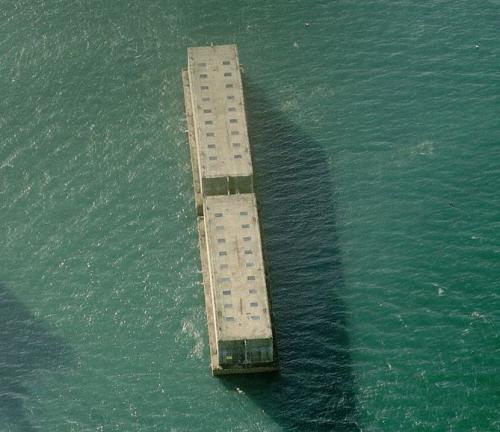
This is a Phoenix type harbor segment: Reinforced concrete caissons constructed by civil engineering contractors around the coast of Britain, collected and sunk at Dungeness, the Cant and Selsey Bay, and then later re-floated and towed across the channel to form the 'Mulberry' harbour breakwaters together with the 'Gooseberry' block ships.
Segments of Mulberry Harbor
No Thumbnail
© Google Maps

© Bing Maps
By kjfitz @ 2006-10-31 23:20:00