Disused Railway Bridge

Disused Railway Bridge (Google Maps)
No Thumbnail
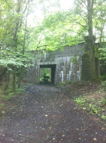
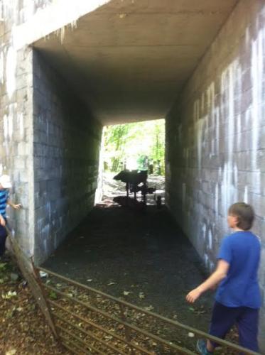
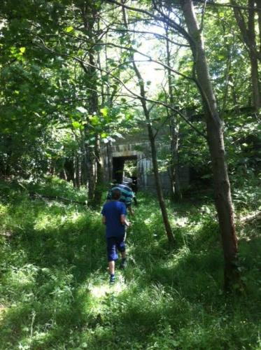
The bridge was part of the railway that went from Dunblane to Perth. The bridge is located on the section of line between St. Fillans station and Dalchonzie halt. This section of the railway was known as the "Lochearnhead, St. Fillans and Comrie Railway" and was in use from 1897 to 1951. The main road that goes from Comrie and through St. Fillans crosses the bridge.

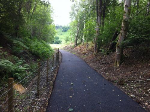
For a long time, the small cutting before the bridge was walkable but overgrown. However, in 2016, the former trackbed was tarmacked as part of a national cycle route that wants to tarmac the whole railway to be used as a bike and walking path.
694 views
Views by date
UnratedRate as 1Rate as 2Rate as 3Rate as 4Rate as 5Rate as 6Rate as 7Rate as 8Rate as 9Rate as 10

Comments

Policies

Please log in if you don't want to post anonymously (anonymous users cannot post links).

Note: VirtualGlobetrotting is an entertainment website is and is not associated with this post, location or person.

Please enable images and enter code to post
Reload

Around the World Mailing List

Pics: 6
Standing on the other side of the bridge. This section of the railway right up to Dalchonzie halt is now a farm track. The bridge opening would have been much wider when trains used it.
Looking at the cutting towards St. Fillans. The bridge is behind the camera. Picture taken in 2016.
A picture I took back in 2013 as I walked through the cutting.
A farm plough sits under the bridge.
Another picture of the cutting as we approach the bridge. This view is looking towards Dalchonzie halt.
A picture I took in 2016 in the cutting towards the bridge. The newly tarmacked path.
Share:

Comments

Policies

Please log in if you don't want to post anonymously (anonymous users cannot post links).

Note: VirtualGlobetrotting is an entertainment website is and is not associated with this post, location or person.

Please enable images and enter code to post
Reload