San Francisco – Oakland Bay Bridge (Western Span)

San Francisco – Oakland Bay Bridge (Western Span)
StreetView StreetView Bing Maps Bing Maps Yahoo Maps Yahoo Maps
By: kjfitz @ 2011-01-25 12:10:42
map #110276
Description:
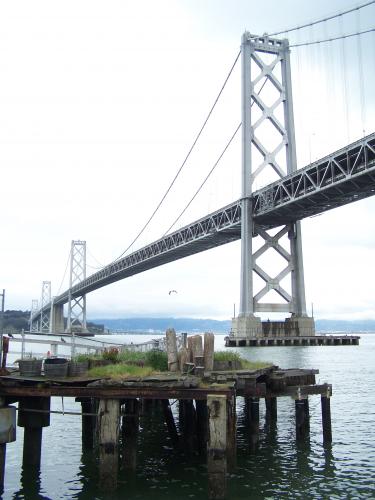
The San Francisco – Oakland Bay Bridge (known locally as the Bay Bridge) is a pair of bridges spanning San Francisco Bay of California, in the United States. Forming part of Interstate 80 and of the direct road route between San Francisco and Oakland, it carries approximately 270,000 vehicles per day on its two decks. It has one of the longest spans in the world.
More Info:en.wikipedia.org
Location: San Francisco, California (CA), US
@ 37.79402700, -122.38235000
Views:
184
Views by date
Rating: Rate as 1 Rate as 2 Rate as 3 Rate as 4 Rate as 5 Rate as 6 Rate as 7 Rate as 8 Rate as 9 Rate as 10 Unrated

Categories

Appears In

Download

Pics: (2)
Nearby Maps (50 km): (2,697)

2,685 more...
Save & Tell
+ My Favorites Email This Map
Share
Your Pics Your Story
Update Thumbnails
Google Google Bing Bing Yahoo Yahoo


Post a Comment: (Policies)

Please log in if you don't want to post anonymously (anonymous users cannot post links)

Your Name: Anonymous
Comment:
Anti-Spam Code:Please enter the code below: