'Star Axis' by Charles Ross

'Star Axis' by Charles Ross (Google Maps)
'Star Axis' by Charles Ross (Bing Maps)
1971/1976 -
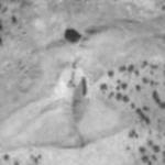
This naked-eye observatory, a kind of modern Stonehenge, is designed to illustrate the 26,000 year precession of the Earth on its axis as represented by the location and path of Polaris, the Pole star, through different eras. Other portions of the structure illustrate the movement of stars in an hour and the position of the sun at the equinox and solstices. It is still under construction, but near completion and should be opening very soon.
5,897 views
Views by date
7.1 (12 votes)
Rate as 1Rate as 2Rate as 3Rate as 4Rate as 5Rate as 6Rate as 7Rate as 8Rate as 9Rate as 10

Comments

Policies

Please log in if you don't want to post anonymously (anonymous users cannot post links).

Note: VirtualGlobetrotting is an entertainment website is and is not associated with this post, location or person.

Please enable images and enter code to post
Reload

Around the World Mailing List

Share:

Comments

Policies

Please log in if you don't want to post anonymously (anonymous users cannot post links).

Note: VirtualGlobetrotting is an entertainment website is and is not associated with this post, location or person.

Please enable images and enter code to post
Reload