Mam Tor - (“The Shivering Mountain”) Mam Tor is 517 metres high and is in Derbyshire near the small town of Chapel-en-le-Frith.
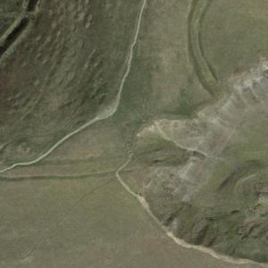
The Shivering Mountain is so named because of the frequent landslips on its eastern face which have produce numerous small hills below.
The landslips on the Shivering Mountain are due to instability of the underlying layers of shale.
Mam Tor is on the southern edge of the Millstone Grit (sandstone) area known as the ‘Dark Peak’ and overlooks the limestone area known as the ‘White Peak”
During the Carboniferous period (the period between 358.9 million years ago and 298.9 million years ago). the High Peak area of Derbyshire was in the tropics and covered by a shallow sea. It was during this period that carboniferous limestone was formed which outcrops in the “White Peak” today.
At the end of the Carboniferous period the High Peak area was a river delta, and it was during this period that the mud, sand and small pebbles were deposited which would later form the shale and sandstone that today outcrops in the “Dartk Peak”.
The end of the Carboniferous period was signalled by a period of mountain building (part of the ongoing Variscan Orogeny which began in the Devonian and continued through the Carboniferous period), and it was this process that led to the formation of the broad folded north to south ‘Derbyshire Dome’ or anticline.
As a result of the Dome formation older rocks (the carboniferous limestones) are exposed at the centre of the Peak District.
Over time weathering of the rocks in the dome has weakened their cohesion and this when combined with their sedimentary nature has resulted in Mam Tor’s instability.
The top layers of rock at Mam Tor are heavily jointed gritstones and weathering can easily cause blocks to break-off and split away. Below the gritstone layers are the less cohesive and consequently weaker shale beds. The lack of cohesion is exacerbated when the shale is wet, and the heavily jointed gritstones are very porous. The conditions for landslips are therefore most likely following heavy rainfall but can occur at any time.
It is believed that the largest landslide on Mam Tor occurred 4000 years ago when the eastern face of the mountain completely slipped away and formed a feature some 35 hectares in area, at the foot of the mountain.
