Deep Dive into History: William the Conqueror

The history books tell us that in 1066, William sailed to England from Normandy, fought a little battle, and took his rightful place on the throne of England. But there’s so much more to the story! On this anniversary of William’s invasion of England, let’s take a deep dive into the life and legacy of the man we know as William the Conqueror.

Birthplace Falaise, Normandy

William was born around 1028 in Falaise, Normandy. His father was the duke of Normandy, and his mother lived in the household. Despite his insecure birthright, he became duke of Normandy when his dad died in 1035. At the time, William was only about 7 years old. William ruled over his duchy from Falaise for years, even after he conquered England.

The current Chateau de Falaise was built about 50 years after William died. It remained a seat of power for Norman and English rulers for another 100 years, before King John (the villain of Robin Hood lore) lost the castle, along with most of his French territories, to the King of France.

Château de Falaise (StreetView)
Château de Falaise

Pevensey Castle, Pevensey, England

After King Edward the Confessor died without an heir, William claimed he had been promised the English throne by the monarch, and determined to take what he saw as his birthright.

He began making plans to invade England from his duchy by crossing the English Channel, which was no easy feat due to strong currents and terrible weather. All summer long, the English waited and watched the southern coast for any sign of invasion from William, but none came.

Long after it was considered safe for fleets to cross the Channel, William took a risk and set sail in late September, landing at Pevensey on September 28, 1066.

Immediately, William order his men to secure the old Roman fortress at Pevensey. The large fort had walls, gates, and towers, which withstood attacks by English defenders. Later, it was further enhanced for protection against insurrection, and to serve as a trade and travel route between Normandy and England.

In World War II, the area was considered a potential invasion point from Germany, and the fort was again used to protect the homeland. These days, the castle and grounds are open to the public.

Pevensey Castle (Birds Eye)
Pevensey Castle

Battlefield, Hastings, England

The pivotal battle that changed the course of history took place on October 14, 1066. King Harold marched from the north of England all the way to the southern tip to defend his country and his crown against what he considered a usurper.

Harold and William fought all day and into the afternoon. It was only after Harold was killed that the English army began to fall apart, and William was able to claim a victory.

On this little battlefield outside the town of Hastings, the course of England’s history changed completely, from one of domestic rule and Ango-Saxon heritage, to external rule, constant battles with France, and a Norman cultural influence. Even the language changed, becoming what we know as “English” today.

Hastings battlefield (StreetView)
Hastings battlefield

Hastings Castle, Hastings, England

Right before the decisive battle, William ordered the construction of a fortification at Hastings, which was later turned into a castle and church. It was used for a few hundred years before falling into disrepair as a result of coastal erosion and weather changes.

It was further damaged during World War II, but has been restored and repaired somewhat. Tourists can visit the castle in the summer months.

Hastings castle (Google Maps)
Hastings castle

Bayeux Tapestry, Bayeux, France

Surprisingly, there are no detailed, accurate accounts of the invasion, battle and aftermath of the war.

Nonetheless, we do have an interesting, if not always accurate or clear, recording of all these events. Sometime shortly after the conquest, a tapestry was commissioned to tell the story of William’s victory. This stitched cloth tells the story in picture form, which was important as most people in that time were illiterate.

The tapestry was a massive undertaking, running 230 feet long, with 58 scenes and intricate detail throughout. Since at least the 1400s, the tapestry has been stored in Bayeux, a small town in Normandy. These days, tourists can view the tapestry in a local museum dedicated to the embroidery.

Bayeux tapestry museum (Google Maps)
Bayeux tapestry museum

Westminster Abbey, London, England

Defeating Harold wasn’t the only thing William needed to do in order to secure the throne. He had an entire country to appease, and getting crowned was an important step in that endeavor. After further skirmishes and intense negotiations with the nobility and church, William was crowned in Westminster Abbey on Christmas Day, 1066. This started the tradition of all English coronations taking place in the Abbey.

The selection of the location was important. Construction on the church had begun under Edward the Confessor as his burial church, and was another way of making it look like William was the natural heir.

The current structure was not constructed until the 1200s, but it has been the seat of royal and religious authority in England for more than a thousand years!

Westminster Abbey (StreetView)
Westminster Abbey

Burial Place, Abbaye-aux-Hommes, France

While William spent some time in England after becoming king, he still viewed Normandy as his seat of power, and gave the French region most of his attention. He and his wife Matilda had bequeathed a large sum to the church in Caen, France, to construct a monastery and nunnery.

Upon his death in 1087, when he was around 59, he was buried in the Abbaye-aux-Hommes. Legend has it that when he was buried, his rotund and rotting corpse did not properly fit inside the casket. When it was closed, his body burst and all the attendees ran from the cathedral in an attempt to avoid the terrible odor. Not quite the ending he envisioned, to be sure.

Abbaye-aux-Hommes (Birds Eye)
Abbaye-aux-Hommes

No matter the state of his funeral, William is without doubt one of the most impactful actors in European history, changing England’s culture, language, and borders, and changing the course of history in France and Europe as well. There’s a lot more to the man, and the story, of William the Conqueror in 1066.


Talking about Pirates

Ahoy! There “rrrrr” a lot of silly holidays, but today’s gets the gold for being rrrreally fun, matey! It’s Talk Like a Pirate Day! So, let’s see some of the places the best, worst, and most famous buccaneers spent time, hid their treasure, and menaced unsuspecting lads and lassies of yore. Be sure to honor the holiday and read on with a true pirate voice!
Port Royal, Jamaica

Pirates ravaged the eastern coast of the US and Caribbean for hundreds of years, from the earliest days of Spanish explorers until countries began to combat piracy more effectively.

Port Royal in Kingston Harbor of Jamaica was the economic hub of the Caribbean for hundreds of years, and was also the epicenter of piracy in the region. An English settlement, leaders of Jamaica permitted and even encouraged targeted attacks on Spanish fleets and settlements. The infamous Blackbeard even took up residence with his family at Port Royal!

Eventually, the citizens grew tired of the pirates, and the port city became a place of reckoning. Calico Jack, Charles Vane and others were hanged, and Mary Read died in prison. A 1692 earthquake and tsunami devastated the city, which was overtaken by Kingston as the most populous and important city in Jamaica by the 1750s.

Port Royal (Google Maps)
Port Royal

Blackbeard’s Castle, US Virgin Islands

Edward Teach, a British sailor turned vicious pirate known as “Blackbeard” because of the fuses he would light in his mane, sailed the Caribbean in the early 1700s.

Legend held that he used Skytsborg tower on St. Thomas in the US Virgin Islands as a look out during his raids and runs from the law. Eventually, the tower became known as “Blackbeard’s Castle” further cementing his larger than life reputation as a wicked pirate.

Blackbeard's Castle (StreetView)
Blackbeard's Castle

Charleston, South Carolina

Charleston, then known as Charles Towne, was one of the earliest English settlements in what is now the United States. With its proximity to the West Indies and protected harbor, it was an attractive economic, and pirate, hub.

Brothels and taverns were common business establishments, especially near the harbor. Pirates could hop off their boat and in minutes, be relaxing with a drink and a lovely lady for an evening.

Blackbeard terrorized the port in May 1718, holding the city hostage with his fleet of ships, demanding a chest of medicine! This feat earned him a reputation for terrorizing sailor, soldier and civilian alike to get what he wanted.

Stede Bonnet, the “gentleman pirate”, was caught near Charleston and taken to the city, where he was hanged on December 10, 1718.

Charleston Harbor (Google Maps)
Charleston Harbor

New Providence, Bahamas

The island of New Providence in what is now the Bahamas was settled in the 1650s as people moved to developing Caribbean and Atlantic settlements.

However, the island and the settlement of Nassau (now the capital city), poorly controlled by any government or leadership, quickly became a haven for pirates, who even outnumbered the civilian population by 1715.

A few years later, a stronger leader finally purged the area of pirates by giving them a pardon if they gave up their criminal ways, and promising a swift capture and execution if they did not.

New Providence (Google Maps)
New Providence

Pirate Island, Île Sainte-Marie, Madagascar

Pirates weren’t limited to the area around the Caribbean. In fact, the Pacific Ocean may have had as much pirate activity as anywhere else!

Ile Sainte-Marie off the coast of Madagascar became known as “Pirate Island” because of the many pirates that would stop there for provisions, water, and to wait out the winds needed to sail back to Europe from their thieving off the coast of what is now India.

After one pirate raid preyed upon a ship owned by the Mughal emperor, English and Mughal efforts combined to eliminate piracy in the region, and political and economic changes in the area reduced the reward for pirates by the 1720s.

Pirate Island, Île Sainte-Marie (Google Maps)
Pirate Island, Île Sainte-Marie

Captain William Kidd’s Sunken Ship, Off the Coast of Dominican Republic

The story of Captain William Kidd is the classic, tragic pirate story. He spent time raiding along the coast of Madagascar, acting with tacit authority from the English government to attack ships from certain countries.

When he realized that he was considered a pirate back home in England, he rushed back to the Atlantic in an effort to clear his name. He first stopped at the small Caribbean outpost of Anguilla, hid his ship, treasure and crew and sailed on to New York. There, legend has it, he buried more treasure.

Unfortunately for Kidd, he was captured, convicted of piracy, and executed.

For hundreds of years, people searched both for the rumored buried treasure and his hidden ship. The ship was discovered in 2007 off the coast of the Dominican Republic. It is still being studied and excavated. Sadly, there’s still no word on the buried treasure…

Captain Kidd's Shipwreck discovered near Catalina Island (Google Maps)
Captain Kidd's Shipwreck discovered near Catalina Island

These are just a few of the many exciting, scary, and captivating stories of adventure, intrigue, and murder. Perrrrfect for a day like today, right Matey?


Dennis Rader, the Bind, Torture, Kill Serial Killer

Serial killers are rare, but from time to time, their actions capture the imagination and fear of the community, and sometimes country. Dennis Rader was one such serial killer, with at least ten victims known to the police. He taunted the public by writing letters to the police and the media, even creating his own “Bind, Torture, Kill” nickname, after the method in which he murdered his victims.

Born in 1945, Rader grew up in and around Wichita, Kansas, often ignored by his parents. Rumors were that he tortured animals from an early age. After college and a stint in the Air Force, Rader returned to the Wichita area, married had a career with a security company. Ironically, fears about the BTK Killer led to an increase in his workload.

BTK Serial Killer Dennis Rader's Former home (Site only) (StreetView)
BTK Serial Killer Dennis Rader's Former home (Site only)

Otero Family

Rader murdered four of five members of the Otero family, on January 15, 1974. He suffocated, strangled and hanged the victims. An older brother came home after the crime to discover the scene. While he left DNA samples at the site, police were not able to identify him, as DNA testing was not possible at the time.

BTK Killings The Otero Family Rader's first victims (StreetView)
BTK Killings The Otero Family Rader's first victims

Kathryn Bright

In April 1974, Rader stalked and murdered Katheryn Bright. He waited for her to return to her apartment, then stabbed and strangled her. He also shot her brother, but he survived the attack. All that remains of the apartment is the land where the building once stood, but the events are still fresh in the mind of the community.

BTK Killings The Bright Murder Victim Number Two (StreetView)
BTK Killings The Bright Murder Victim Number Two

That fall, a letter written by Rader talking about the Oteros murders and coined his own nickname, stating “The code words for me will be bind them, torture them, kill them, B.T.K.” It was published in the local papers and fueled panic about a killer loose in the area.

Shirley Vian

In March 1977, Rader committed his next known crime, strangling Shirley Vian in her home while her children were locked up within the house. While he intended to kill the children, he was interrupted and never finished his intended crimes. The home is still a private residence.

BTK Killings The Vian Murder Victim number three (StreetView)
BTK Killings The Vian Murder Victim number three

Nancy Fox

Rader’s seventh victim was Nancy Fox. In December 1977, he broke into her home, hiding in her closet until she returned home. He bound her, strangled her and before he left the scene, he called and notified the police of the murder. His call was recorded and used on local broadcasts to attempt to find him, but the efforts were unsuccessful. The Fox crime scene is still a private residence.

BTK Killings The Murder of Nancy Fox Victim number Four (StreetView)
BTK Killings The Murder of Nancy Fox Victim number Four

Shortly after, in January 1978, Rader wrote the local newspaper about his crime, and then later sent another note to a television news channel, taking credit for Vian’s murder, as well as another never identified.

Rader earned his degree in Administration of Justice, had two children and became a volunteer in his community, including in his church and as a boy scout leader around this time.

Marine Hedge

Rader attempted to stalk and murder other victims, but was foiled for various reasons. His next attack was in April 1985. He broke into the home of his neighbor Marine Hedge, waited while she had company, and then when she was alone, he strangled her with his hands. He left her body on the side of the road to be discovered four days later. The home is a private residence.

BTK Killings The Murder of Marine Hedge (StreetView)
BTK Killings The Murder of Marine Hedge

Vicki Wegerle

In September 1986, Rader posed as a telephone repair man to gain access to Vicki Wegerle’s home. Once inside, he threatened her with a handgun and tied her up with bindings, but she worked herself free and the two struggled before he finally murdered her with nylon stockings. The home of his ninth victim is still a private residence.

BTK Killings The Murder of Vicki Wegerle (StreetView)
BTK Killings The Murder of Vicki Wegerle

Dolores Davis

Rader’s tenth and last known victim was murdered in January 1991. His oldest victim, Dolores Davis, was 62 and lived alone. She had recently retired. Rader broke into her house and strangled her with a nylon stocking. He removed her body and disposed of her body under a bridge, where she was found 13 days later.

Dolores Davis murder site (Dennis Rader "BTK killer") (Google Maps)
Dolores Davis murder site (Dennis Rader "BTK killer")

Rader corresponded with the media and police throughout his active years, but went silent after 1988. It wasn’t until 2004, the 30th anniversary of the first BTK killing, that he resumed sending letters and packages to the media, likely in response to increased coverage of the cold cases.

His communications eventually led to his arrest on February 25, 2005. Later that year he pleaded guilty to ten first degree murders, and was sentenced to ten life terms in prison.

While we will never know if the ten victims were all that Rader killed, it was widely assumed by law enforcement and the justice system that had he committed any more crimes, his ego would have forced him  to confess to them if only to take credit for them in his mind.


Tribute to 9/11

On the morning of September 11, 2001, airplanes crashed into the World Trade Center, the Pentagon, and in a rural area in Pennsylvania.

Each year, it is important to look back and remember what happened and recommit ourselves to never forget; to honor those who died, those who have since fought to protect the United States and the world from terror, and those who live with the scars of that day and everything it impacted.

Twin Towers, New York City, NY

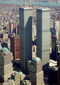
Since the late 1960s, the World Trade Center towers dominated the New York City skyline, a landmark for tourists and a destination for international commerce in the United States.

New Twin Tower
Photo Credit http://www.wikipedia.com

Early on the morning of Tuesday, September 11, 2001, terrorists hijacked two airplanes, Flight 11 and Flight 175, and crashed them into the North and South towers of the World Trade Center.

Damage to the buildings was so extensive that, roughly ninety minutes after the airplanes hit, the buildings collapse, and debris and fire caused all of the other buildings of the World Trade Center complex to completely or partially collapse.

World Trade Center Site (Google Maps)
World Trade Center Site

The area of impact was reduced to a mass of rubble several blocks wide, and was the center of intensive search for survivors, remains and clues as to who was behind the attack and what caused the seemingly invincible skyscrapers to collapse.

This area was nicknamed “Ground Zero” and became a place of mourning, hope and renewal.

Ground zero, World Trade Center Site (StreetView)
Ground zero, World Trade Center Site

Many displays of tribute and respect were erected throughout the city. Several more permanent displays were created, including works of art honoring the fallen such as this mural by Yakov Smirnov.

Yakov Smirnov's "America's Heart" mural (Birds Eye)
Yakov Smirnov's "America's Heart" mural

Immediately after the attacks, New Yorkers vowed to rebuild and remember, refusing to be subdued by the terrorists.

Construction of One World Trade Center began in 2006, and was completed in 2014. It is the tallest building in the Western Hemisphere.

One World Trade Center (StreetView)
One World Trade Center

An important part of the reconstruction was a museum and memorial to remember those killed, the survivors, and the first responders.

The National September 11 Memorial and Museum opened partially in 2011 and was completed in 2014.

9/11 Memorial - North Pool (StreetView)
9/11 Memorial - North Pool

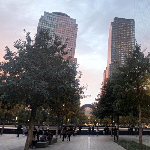
The design of the memorial includes a forest of white oak trees and two square reflecting pools with deep waterfalls on the footprint of the two fallen towers.

9/11 Memorial - South Pool (StreetView)
9/11 Memorial - South Pool

Names of the fallen are written on parapets surrounding the pools, with the victims of the North building and related airplane honored at the north pool and victims from the South building and airplane at the south pool.

Additionally, the six victims from the 1993 attack are commemorated at the south pool.

South Tower Memorial, United Flight 93 (StreetView)
South Tower Memorial, United Flight 93

Here is a close up of some of the names of those who perished.

Garnet "Ace" Bailey 9/11 memorial (StreetView)
Garnet "Ace" Bailey 9/11 memorial

Pentagon, Arlington, VA

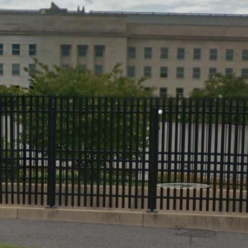
The Pentagon, the nation’s center for defense and military operations, is  located just outside Washington, D.C. About 26,000 people, civilians, military, work at the Pentagon each day.

Pentagon (Google Maps)
Pentagon

Shortly after the two planes crashed into the Twin Towers in New York City, another hijacked airplane, Flight 77, crashed into the Pentagon. Between the airplane and the Pentagon, 189 people were killed. The plane crashed through three of the five rings of the building before exploding. Fires burned for several days before being fully extinguished.

The nation’s defense team, headquartered at the Pentagon, refused to be swayed by the attack, and returned to work the very next day, in spite of the burning fires and chaos going on all around them.

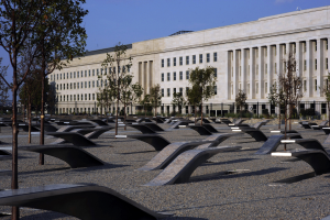
An outdoor memorial to the fallen was constructed outside the Pentagon and opened on September 11, 2008. A wall on the perimeter of the memorial starts out at three inches high and goes to 71 inches, indicating the age span of those killed in the attack, from three years to 71 years old.

There are 184 illuminated benches, one for each victim. The name of a person is engraved on each bench, with the names of the airplane passengers facing upwards to the sky and the Pentagon employees facing north, toward the building.

There is also an illuminated flowing pool of water under each bench.

Pentagon Memorial (StreetView)
Pentagon Memorial

Pentagon Memorial

Photo Credit http://www.wikipedia.com

Shanksville, PA

The fourth and final airplane to crash that day went down in a rural area near Shanksville, PA.

Passengers and flight attendants on Flight 93 were able to place calls to loved ones, letting them know they had been hijacked, and were told that other planes had already crashed into sites in New York and Virginia.

Brave people on the plane stormed the cockpit, leading to the plane crashing in rural Virginia, rather than be used as a missile to hit an assumed target of the U.S. Capitol Building.

Had it reached its intended target, countless government leaders, employees and civilians would have been killed that day. It would have been a devastating blow to the American government and morale.

Flight 93 National Memorial (Google Maps)
Flight 93 National Memorial

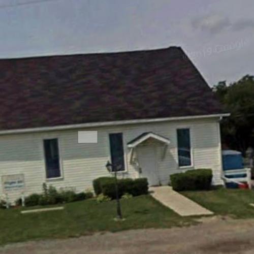
The site quickly became a memorial for those mourning the loss of their loved ones. A nearby abandoned chapel served as a place of solace and communion for those mourning their loved ones, and it eventually became a makeshift memorial.

Flight 93 Memorial Chapel (StreetView)
Flight 93 Memorial Chapel

Forty victims died that day in Pennsylvania, 39 from the airplane and one on the ground. The memorial commemorates the fallen with a circle in the field designed to resemble an embrace.

The memorial also includes a 93 foot “tower of voices” which holds 40 wind chimes, one for each victim.

9/11 Flight 93 Crash Site and Memorial (Google Maps)
9/11 Flight 93 Crash Site and Memorial

Between the three sites, the victims on the airplanes and the first responders who were killed during the collapse of the Twin Towers, nearly 3,000 people died that day. Many more have died since then due to exposure to chemicals and dust in the cleanup efforts and from exposure to the dust and toxins from Ground Zero in Lower Manhattan.

It is important to bear witness to the events of that day; it is important that we will never forget.

In a California State of Mind

When California joined the United States as the 31st state on September 9, 1850, it was seen as a land unlike any other place in the country. Massive trees that reached to heaven, mountains filled with gold to make men millionaires, deserts that stretched hundreds of miles, beaches with beautiful vistas, and so much more.

Let’s take a look at some of California’s natural wonders that make it “The land of milk and honey”.

Presidio Park, San Diego

While California has been inhabited for thousands of years, Spanish explorers  in the 1500s wanted to settle, farm, and develop the land. The first permanent European settlement in California, and on the west coast of the US, was in present-day San Diego. The Presidio of San Diego served as a base for religious and cultural expansion.

While the original structure no longer exists, the area on which the Presidio once stood has been turned into a lovely park and declared a National Historic Landmark.

There’s no better way to start a journey of California’s highlights than at the San Diego Presidio Park, where you can enjoy the beauty of the land, the bay, and the city all at once.

Presidio Park (Google Maps)
Presidio Park

Yosemite National Park

One of the most breathtaking areas in California is on the east side of the state, in the Sierra Nevada Mountain Range. Gorgeous granite cliffs, ancient rock formations, stunning waterfalls, and amazing forested valleys reward any visitor. John Muir and others worked to protect the unique area, and it was set aside as first a state park and then a national park.

Yosemite National Park (Google Maps)
Yosemite National Park

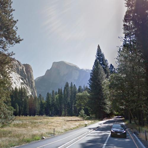
Half Dome on the south end of the park is one of its most recognizable features. The smooth granite looks like a dome cut in half, and was for a long time believed to be impossible to climb. These days, routes have been anchored into the side of the rocks, making it so popular that at times in the summer, it’s actually crowded!

Half Dome in Yosemite National Park (StreetView)
Half Dome in Yosemite National Park

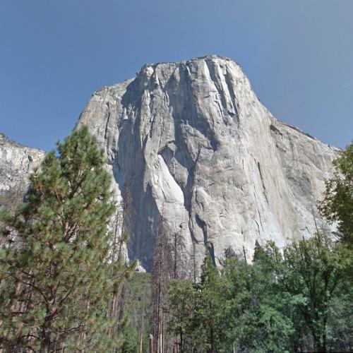
El Capitan

On the north end, El Capitan is another granite formation that attracts visitors from around the world. The 3,000 foot monolith juts out of the valley below, beckoning  talented and adventurous climbers from around the world to scale the steep face.

El Capitan (StreetView)
El Capitan

Lake Tahoe

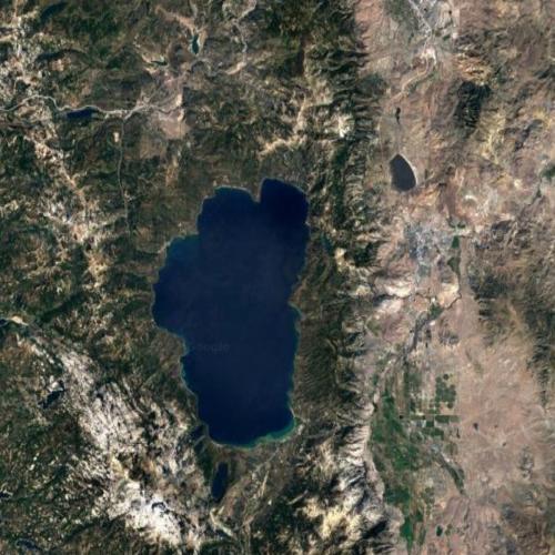
Just a few hours north, a short drive in California terms, is world-famous Lake Tahoe. The large alpine lake draws global visitors who want to see one of the largest lakes in the world, surrounded by picturesque vistas, varied wildlife, and lots of outdoor activities.

Dáʔaw / Lake Tahoe (Google Maps)
Dáʔaw / Lake Tahoe

Now partly a national park on California’s side (and dotted with casinos on Nevada’s side), Lake Tahoe has a reputation as an upscale and trendy place to visit, whether it’s in the summer for water and mountain activities, or in the winter for amazing skiing, complete with breathtaking lake views.

High Atop Heavenly Valley Ski Resort (StreetView)
High Atop Heavenly Valley Ski Resort

Joshua Tree National Park

Joshua Tree National Park in the Mojave Desert is otherworldly, a desert landscape named after the unique tree whose branches reach out like arms, with bushy leaves like arms and fingers. The tree’s roots can reach 30 feet or more under the ground, and trees can survive in the desert for more than a thousand years.

The national parks is larger than the state of Rhode Island, which emphasizes just how big California is, as the second-largest state in the Union.

Joshua Tree National Park (StreetView)
Joshua Tree National Park

Big Sur

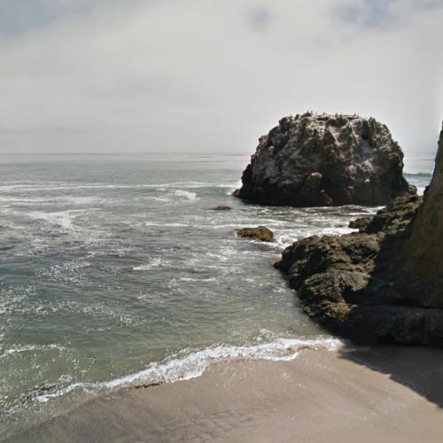
California is known for its beaches, and Big Sur is the largest stretch of undeveloped coastline in the contiguous United States. People love to drive on Route 1, checking out the views of the coast, and enjoy the smaller cities and towns along the way. Andrew Molera State Park is a beautiful, undeveloped, rocky beach area.

Molera Point (StreetView)
Molera Point

Bixby Creek Bridge

Big Sur doesn’t just include the gorgeous beaches, but rocky mountains and deep valleys along Route 1. Bixby Creek Bridge is an architectural marvel, at 290 feet above the ground below, and with the ocean stretching out forever, making it both a little intimidating to cross, and unforgettable.

Bixby Creek Bridge (StreetView)
Bixby Creek Bridge

Redwood National Park

California is home to not one but two of the biggest trees in the world! Redwoods, a form of sequoia that have adapted to the foggy, coastal climate, stretch up to almost 400 feet high! They are the tallest trees in the world!

Redwood National Park and Redwood State Park have set aside thousands of acres of forests along the coast, protecting the ancient trees from further deforestation. Tourists flock to the area to view these natural wonders, as well as enjoy the rocky coastline that is so different than the sandy, hot beaches of southern California.

Redwood National Park (StreetView)
Redwood National Park

General Sherman, Sequoia National Park

A few hundred miles east are the other famous California trees: the giant sequoias of Sequoia National Park. General Sherman is considered the biggest tree, because it has the widest trunk and is the largest living single-stem tree in the world.

Other trees of this size have been felled by storms and people, so having a national park to protect the plants is an important development. It allows people to view and enjoy the remarkable, ancient trees for years to come, and allows them to grow, thrive, and do their part to keep our planet healthy and green.

Tourists come from around the world to marvel at the living phenomenon, and appreciate the variety and wonder that nature has created.

General Sherman (StreetView)
General Sherman

California has a reputation for being bigger and better, with more people, more land, more celebrities, more of everything. And this list certainly proves that the state has a lot to be proud of, with some of the most amazing natural marvels in the 50 United States.

Deep Dive into History: The Burning of Washington, DC

The Revolution wasn’t the last time the US and Britain fought against each other in a war. The War of 1812 took place on US soil, over territorial expansion on the North American continent. Let’s take a deep dive into the last time a foreign power invaded our capital city, when the British invaded Washington, DC on August 24-25, 1814.

USS Constitution, Boston, Massachusetts

The war broke out in 1812 as the US expanded its territory into areas formerly claimed by the United Kingdom. While the battle was fought on territory from Canada in the north to New Orleans in the south, it was also fought on water, between warring sea vessels.

The USS Constitution, built in the late 1700s, was one of the most effective American ships during the War of 1812. She defeated five British ships in battle and captured countless other ships.

The ship was so popular that she was preserved and earned the nickname Old Ironsides because she regularly avoided destruction in battle.

These days, visitors can see the oldest ship still afloat, in the Boston Harbor, close to where she was built more than 300 years ago.

USS Constitution (Birds Eye)
USS Constitution

Fort McNair, Washington, D.C.

On the southern tip of the capitol city, Fort McNair, was designed to protect the city from an invading force. In August 1814, the British were advancing through Maryland, defeating untrained and poorly organized militias along the way.

Soldiers at Fort McNair abandoned their post, and British troops were able to take Washington, D.C. on August 24. According to reports, before the American soldiers left, they hid much of the gunpowder in a well. An unsuspecting British soldier tossed a match into the well, causing a horrific explosion and killing at least 30 soldiers. This incident was the greatest loss of life for the British in the city.

The fort was later used as an ammunition factory in the Civil War, and another explosion of gunpowder killed at least 21 female workers. These days, the fort is home to the National Defense University, the headquarters of the local military, and the residence for several high-ranking service members. Needless to say, they don’t store gunpowder there anymore.

Fort McNair Main Gate (StreetView)
Fort McNair Main Gate

US Capitol Building, Washington, DC.

British troops were given permission to sack Washington, D.C., and loot the city. They were also given permission to burn public and important buildings as retaliation for previous actions taken by American soldiers.

At the time, the building was home to Congress, as well as the Library of Congress and the Supreme Court. The building was looted and damaged, and then soldiers set it ablaze. Burning from both the southern and northern wings, the damage to the structure was significant. The library was incinerated, and beautiful decor was ruined.

The fire didn’t destroy the building, and it was redesigned to be bigger and more impressive after the war ended. Today, the Capitol building is one of the most beautiful buildings in the city.

US Capitol Building (Google Maps)
US Capitol Building

White House, Washington, D.C.

The British soldiers even had permission to burn the White House, which was considered a serious act of war. Knowing opposing forces were coming, President Madison and his family evacuated the city right before troops arrived. His wife, Dolly, and several enslaved people who worked in the White House, rushed to save valuable and sentimental items from the White House.

The evacuation was so rapid that the invading troops actually sat down and ate dinner prepared for the President and his guests. After sacking the building and taking what items they wanted, soldiers set the executive mansion on fire, with added wood to ensure it would burn entirely.

The White House (StreetView)
The White House

Portrait of George Washington

One of the items preserved from the fire was the famous portrait of George Washington, painted by Gilbert Stuart. The original, ironically, was gifted to a former Prime Minister of England, but three impressive copies remained in the US. One, rescued that fateful day, is still displayed in the White House.

In 2009, then-president Obama held a ceremony honoring the people who saved an iconic piece of American history, as well as other valuable items that day. It was a meaningful event for the descendants of enslaved people to attend the White House under such different circumstances.

Portait of George Washington in The White House (StreetView)
Portait of George Washington in The White House

Navy Yard, Washington, D.C.

While American soldiers had burned much of the shipyard and the vessels in it, the invading British soldiers made sure to destroy the Navy Yard even further, rendering it useless in the war. Several important ships and many structures were ruined, negatively impacting the military’s ability to plan and prepare for future battles.

However, the site has been restored and upgraded, and still serves as a headquarters for military functions in the nation’s capital.

Washington Navy Yard's Latrobe Gate (StreetView)
Washington Navy Yard's Latrobe Gate

Just hours after the devastation began, a massive storm hit the city, with intense winds, rain, and even a tornado. The storm, which many now suspect was a hurricane, was so intense it put out fires at many of the burning structures around the city. It was so bad, it caused the British leaders to retreat to their ships, many of which had been damaged in the storm.

An act of nature did what American soldiers could not do that day–defeated the British and forced them from America’s capital city.

These events were certainly the low point of diplomatic relations between the two countries, but time has healed any wounds left by the war, and the United States and United Kingdom are now the closest of allies.

Cool Golf Courses around the World

August is a great time to be outside, and spending a morning on the golf course is a great way to enjoy the outdoors, get some exercise, and spend some time catching up with friends along the way. Let’s take a look at some of the best, and most famous, golf courses from around the world.

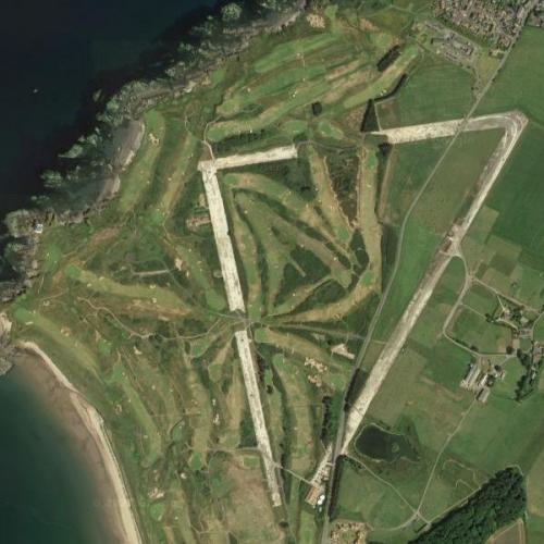
The Old Course at St. Andrews, St. Andrews, Scotland

Golf as we know it started in Scotland in the 1400s, a challenging game where people whack a dimpled ball with a stick across wide spaces often filled with hazards such as ponds, sand pits, and trees.

The Old Course at St. Andrews Links is one of the oldest known locations where golf was played, and it is where the rules of golf as we know it originated. The course is famous for its bunkers, hills and challenges, as well as its beautiful vistas, challenging design, and historical value.

The oldest professional competition, the Open Championship or British Open, is played here every five years. Legendary golfer Bobby Jones considered it his favorite course.

St Andrews Links (Google Maps)
St Andrews Links

Pebble Beach Golf Links, Pebble Beach, California

An ideal golf course has a sandy soil with a grass cover, some hills and some land features. Therefore, courses are often near the beach, as is the case with Pebble Beach in California. The course has a beautiful view of Carmel Bay and the Pacific Ocean.

The PGA Tour hosts an annual event at the course, which consistently ranks as one of the best golf courses in the US, and the US Open has been hosted here a number of times. There are three other golf courses in the Pebble Beach area that consistently make the list for best courses in the US.
Pebble Beach Golf Course (Google Maps)
Pebble Beach Golf Course

Pinehurst Golf Course Number Two, Pinehurst, North Carolina

Pinehurst is a town in North Carolina that has nine 18-hole courses, but it’s course number two that is the most famous, and regularly ranked as one of the best courses in the US. Courses are evaluated based on the design of the course, landscape, layout, and more.

The course is more than 100 years old, and is famous for its difficult green complexes, including greens that are higher than the area around them, making it difficult to land the ball without it rolling away. Several major professional events have been held here, and there are plans to host the US Open here several times in the coming years.

Pinehurst (Google Maps)
Pinehurst

Cypress Point Club, Pebble Beach, California

Often stated to be the most beautiful course, Cypress Point Club in Pebble Beach is just down the way from several other famous links. The course is famed for its beauty, but the club that owns the course is famous for being so exclusive, it refused to allow Black members for decades.

These days, it has changed its policy, but it’s still nearly impossible to join, as the membership fee alone is around $250,000. Not just anyone with that amount of cash lying around can join, you actually have to be invited.

Because the club is so exclusive, the links are regarded for their privacy and peaceful feeling for players. On an average day, only 30 or so golfers play the course, a significantly lower number than any public course.

Cypress Point Club (Google Maps)
Cypress Point Club

Royal County Down Golf Club, Newcastle, Northern Ireland

While golf originated in Scotland, it is also very popular in Northern Ireland, just across the Irish Sea. Royal County Down Golf Club actually has two courses, one of which is regularly atop the lists of best courses in the world. The Championship course has hosted dozens of international matches and events.

The course starts out easy, and builds in momentum and difficulty, but while the holes are challenging, they are also enjoyable. The views, especially in spring and early summer, are breathtakingly beautiful. When you see this course, it’s easy to understand why people love golf, even when they’re not very good at it.

Royal County Down Golf Club (Google Maps)
Royal County Down Golf Club

Turnberry Golf Course, Ayrshire, Scotland

Turnberry was founded in 1906, and has maintained a well-deserved reputation as a premier golf resort since its inception. The Alisa course has long been a championship course, and was the site of the 1977 “Duel in the Sun” where Jack Niclkaus and Tom Watson dueled it out on the links. Watson ended up winning by one stroke, and set  an Open record with a low total score.Turnberry Resort was used during the World Wars as a military hospital and air force training area. In 2014, Donald Trump bought the property for  a reported $60 million, and according to some accounts, invested significantly in the property. It is a classic Scottish golf course, with hills, traps, ocean vistas, and unpredictable weather, so golfing here is a perfect way to honor the sport.

Turnberry (golf course) (Google Maps)
Turnberry (golf course)

Looking at these beautiful courses from around the world, it’s easy to see why so many people enjoy recreational golf; you get to spend time outdoors in beautiful settings, getting a little exercise while spending time with friends or enjoying some time alone. No matter what, it’s always a great day for a little golf.

Beautiful Capitol Buildings of the World

There are 195 countries in the world today, and each has a seat of power where their leaders gathers for official and ceremonial governing of the country.

Each capitol buildings represents their country’s independence. Some buildings go beyond functional and are stunning works of art.

Reichstag

The Reichstag is a neo-Renaissance structure in Berlin that houses Germany’s Bundestag, or parliament. It housed the German legislature from 1894 to 1933, when it burned down under suspicious circumstances, likely under Hitler’s orders.

Reichstag (Birds Eye)
Reichstag

During World War II and the division of East and West Germany, it fell into disrepair. When the country was reunified in 1990, a great symbol of reunification was that the government again met in the building.

Reichstag (StreetView)
Reichstag

The building originally had a large glass dome, remarkable for its time, but it was damaged in the 1933 fire and during World War II bombing.

As part of the renovation in the 1990s, a great glass dome was installed, which provides a beautiful finish to the building, as well as an amazing 360 degree view of Berlin from inside the dome, an experience not to be missed!

dome

Top of the Reichstag dome (StreetView)
Top of the Reichstag dome

U.S. Capitol Building

The U.S. Capitol Building in Washington, D.C. houses the country’s legislative branch of government. The rectangular neoclassical building is home to the Senate and the House of Representatives. The two co-equal bodies work in the two wings of the Capitol. The great cast iron dome, which was installed during the expansion in the 1850s, gracefully completes the building.

US Capitol Building (Google Maps)
US Capitol Building

Construction began in 1793, with George Washington laying the cornerstone. The building was built with slave labor, which has since brought shame to the government. During the Civil War, the large Rotunda in the center of the building was used as a hospital for wounded soldiers, and stories abound about the lost souls of laves and soldiers haunting the halls today.

US Capitol (StreetView)
US Capitol

Scottish Parliament

While Scotland is part of the United Kingdom, recent laws have granted more authority and power back to the regional government in Edinburgh , a process called devolution.

The government has met since 2004 in the Scottish Parliament Building, which is a very modern design that draws on Scottish themes, landscapes and traditions. The roof line represents Scottish landscapes and upturned fishing boats, and the governing body meets directly above public meeting spaces to remind them that their power comes from those below them.

The structure has received much recognition, and some criticism, for its design, sustainable features and creativity. It is widely recognized as one of the most interesting capitol buildings in the world.

'Scottish Parliament Building' by EMBT (Birds Eye)
'Scottish Parliament Building' by EMBT

Palace of Westminster

The Palace of Westminister was originally constructed in the 11th century as a royal palace, and after a fire in 1512, officially became the house of the Parliament of England. Another fire caused significant damage in 1834, and it was damaged by bombs during World War II, but the Parliament has always rebuilt.

Palace of Westminster (Birds Eye)
Palace of Westminster

Westminister has three towers, the most famous of which is Big Ben, which features a giant clock with faces on all four sides of the tower. Built in the 1850s, the clock has remained remarkably accurate, and bells mark the time each quarter hour.

Houses of Parliament and Big Ben (Google Maps)
Houses of Parliament and Big Ben

Hungarian Parliament

The Hungarian Parliament Building in Budapest was designed as a grandiose structure to commemorate the sovereignty of the young nation. Completed in 1904, the Gothic Revival structure built along the Danube River is the largest building in Hungary, and is a beautiful work of art, especially lit up at night.

The building serves as a living history of the country, with artwork, frescoes, stained glass and statues telling the story of the country and recognizing famous and important historical figures. One of the most moving features are the pellets on the exterior walls that mark the bullet holes from the 1956 revolution, when citizens rose up in an unsuccessful attempt to overthrow their oppressive and unelected Communist government.

Hungarian Parliament Building (StreetView)
Hungarian Parliament Building

These are just a few of the many fascinating capitol buildings throughout the world, and they highlight the unique culture and history of each country they represent. If you’re ever in a capital city, you should certainly seek out their capitol building to learn more about the country and appreciate it’s government.


Amazing Lighthouses Shining around the World

You may not know it, but August 7 is National Lighthouse Day in the United States. So, let’s take a look at some of the brightest, boldest, and most unique lighthouses from around the world.

Cape Hatteras Light, Cape Hatteras, NC

The Outer Banks off the coast of North Carolina is a group of barrier islands in the Atlantic Ocean. As ships come up the North Carolina coast, they can run into powerful swells and storms near Cape Hatteras. The shifting sandbars led to the area earning the ominous nickname “Graveyard of the Atlantic”.

One of the oldest lighthouses in the US, the original Cape Hatteras Light was built in 1802, but was quickly recognized as insufficient for the needs of the area. The current structure, which is the tallest lighthouse structure in the US and second-tallest in the world, is widely recognized by its bold black and white diagonal stripes.

Cape Hatteras Lighthouse (Birds Eye)
Cape Hatteras Lighthouse

Hook Lighthouse, County Wexford, Ireland

Also given a bold black and white paint job, which helps sailors identify the landmark structure during the day, the Hook Lighthouse on the other side of the Atlantic, is famous for being the second oldest operating lighthouse in the world! The existing tower has stood 850 years, while other lighthouses were installed on the same location as far back as 400 AD.

The lighthouse warns sailors of the dangerous rocks of the peninsula, especially during the regular and sudden fogs that strike the outcropping. Originally, guns were fired to warn of the shoals during foggy periods, but now, technology allows sailors to guide their ships safely even when visibility is low.

Hook Lighthouse (StreetView)
Hook Lighthouse

Chania Lighthouse, Crete, Greece

The Chania Lighthouse is one of the oldest lighthouses, originally built by the Venetians back when the city-state controlled much of the Mediterranean. While the lighthouse was destroyed centuries ago, the base remained. In the 1860s, a new lighthouse was built on the existing base. It is considered one of the most beautiful lighthouses, especially when viewed at night.

The 85 foot high stone minaret is lit up at night, creating a warm, romantic glow that fills the sky. The glow serves as an additional visual marker in addition to the light at the top, which can be seen for nearly ten miles.

Chania Lighthouse (Birds Eye)
Chania Lighthouse

Cape Espichel Lighthouse, Castelo, Portugal

Another old European beauty, the Cape Espichel Lighthouse was originally built by an order of monks who built a community to honor an image of the Virgin Mary, which was found on the rocky site. As pilgrims came to see the holy relic and worship, the monks recognized the need for a lighthouse to ensure the safety of the travelers. The area was known as the “Black Coast” because it was so dark and difficult to navigate.

With a low, wide building at the base, the lighthouse reaches up more than 100 feet into the air, with thick walls making a hexagonal tower. It is painted white, with a beautiful traditional red clay roof. Guests are able to tour the lovely structure at least once a week.

Cape Espichel Lighthouse (StreetView)
Cape Espichel Lighthouse

Portland Head Lighthouse, Cape Elizabeth, Maine

The Portland Head Lighthouse was one of the first lighthouses funded by the new American government, and details about construction and management were overseen by none other than George Washington! The lighthouse guides ships into the Portland Harbor, one of the most important shipping lanes in the Northeast.

The height of the structure had to be enhanced a few times, as builders realized that it needed to be much taller to be visible to sailors. It was originally lit with whale oil, but is now illuminated by electrical power. Like other areas on the north Atlantic, fog often covers the area, so the lighthouse also has fog signals to keep people safe under all weather conditions.

Portland Head Lighthouse (Birds Eye)
Portland Head Lighthouse

Split Rock Lighthouse, Silver Bay, MN

Not all lighthouses protect sailors on the open ocean. Some lighthouses are built along dangerous rivers or large lakes, like the Split Rock Lighthouse on the North Shore of Lake Superior in Minnesota.

In addition to serving a unique purpose, the lighthouse is considered one of the more beautiful lighthouse structures in the US. Positioned at the top of a high cliff, the beautiful brick lighthouse is a striking image against the water and sky.

While the lighthouse is no longer in use, it has been turned into a state park, and visitors and campers can take in the picturesque views all year round.

Split Rock Lighthouse (StreetView)
Split Rock Lighthouse

These are just a few beautiful and historical lighthouses around the world that keep people safe from dangerous waves, dense fog, and rocky shoals.

Visiting NASCAR Tracks

NASCAR is a favorite American pastime, a fun spectator sport where you can cheer loudly, drink a lot of beer, and check out cool engines and fast cars. NASCAR is the most popular stock car racing organization, with several racing series taking place throughout the year, including the most famous and prestigious Monster Energy NASCAR Cup Series. Races are held at different venues across the United States, and with sites in 39 states, you’re never very far from a NASCAR experience.

If you find yourself with a need for speed, these tracks will not let you down.

Darlington Raceway

Located just outside Darlington, South Carolina, the raceway has a grand reputation in NASCAR. It’s track is a unique egg shape rather than a more symmetrical and traditional oval. Legend has it that the shape comes from the builders being required to leave a nearby minnow pond undisturbed. The odd design makes the track more challenging, and has earned it the nickname “The Track Too Tough to Tame”. When a racer hits the wall, they’ve earned their “Darlington stripes”.

Darlington Raceway (Google Maps)
Darlington Raceway

Charlotte Motor Speedway

Charlotte is one of the biggest hubs in NASCAR, and its amazing track lives up to the reputation North Carolina has as the home of NASCAR. The track is 1.5 miles and the stadium holds nearly 90,000 spectators and has the second largest video board in the world. The speedway hosts the Coca-Cola 600, one of the most important races of the series, and hosts over 380 events a year.

Charlotte Motor Speedway (Google Maps)
Charlotte Motor Speedway

Bristol Motor Speedway

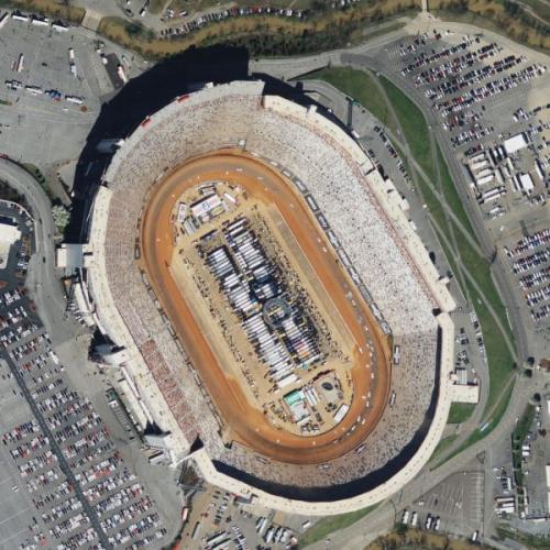
The Bristol Motor Speedway in Tennessee is a short track and just one half mile, which makes for a very different racing and viewing experience than at other NASCAR tracks. The short track also leads to more “paint swapping” as cars are packed tight on the track, and lots of drama from drivers dealing with different issues than on tracks with longer straightaways. Nicknamed “Thunder Valley” due to the loud volume of the cars racing in the venue, it holds more than 160,000 spectators and is the fourth largest sports venue in the United States.

Bristol Motor Speedway (Birds Eye)
Bristol Motor Speedway

Talladega Superspeedway

Located just north of Talladega, Alabama, this is the longest track in NASCAR at 2.66 miles. It has a current seating capacity of 80,000. Because of the long track and straightaway, vehicles can reach higher speeds than on other tracks, and the NASCAR speed record was set here in 2004, at 216 mph. For a time, vehicles were going so fast that their tires would burst, unable to handle the pressures of such speed. There is a “Talladega curse” that some attribute the many accidents and tragic injuries and deaths at the site to. The superspeedway was ensconced in pop culture in the 2006 film “Talladega Nights: The Legend of Ricky Bobby” starring Will Ferrell.

Talladega Speedway (Google Maps)
Talladega Speedway

Daytona International Speedway

No article on NASCAR would be complete without talking about the Daytona International Speedway, home of NASCAR’s headquarters and the premier race, the Daytona 500. Daytona is famous for many things, including the tragic death of racing legend Dale Earnhardt in the final lap of the 2001 Daytona 500.

Daytona International Speedway (StreetView)
Daytona International Speedway

The track is a 2.5 mile “tri-oval” which is a hybrid triangle-oval shape with six turns. Like Talladega, which also features the tri-oval, drivers on the Daytona speedway must use restrictor plates to limit the top speeds in order to avoid high speed accidents.

Daytona International Speedway (Google Maps)
Daytona International Speedway

Martinsville Speedway

Often ranking high in list of NASCAR’s best tracks for fans, the Martinsville Speedway just south of Martinsville, Virginia is the shortest track in the Cup Series, and one of the oldest. At just over one half mile and with very low banking in the turns, this classic “paperclip”  oval track requires significant skill and attention to hard braking at the turns and smooth accelerations in the straightaways. The speed record for one lap is just over 18 seconds, which is insanely fast!

Martinsville Speedway (Birds Eye)
Martinsville Speedway

Here’s a view of turn four, which shows how flat the track is!

Turn Four at Martinsville Speedway (StreetView)
Turn Four at Martinsville Speedway

Indianapolis Motor Speedway

The Indianapolis Motor Speedway is probably most famous for its Indy car race the Indy 500, but it is also famous for the Brickyard 400, a premier NASCAR Cup race. It is the largest capacity sports arena in the world, holding over 400,000 people in stadium, infield and other seating. The facility is over 100 years old, and has witnessed the development of auto racing from its chaotic early days to the present high-tech experience.

Indianapolis Motor Speedway (Birds Eye)
Indianapolis Motor Speedway

The Brickyard 400 is part of the NASCAR Cup series and is generally raced in late summer. The race has had the highest attendance of all NASCAR races and second highest purse for the winner, second only to Daytona. In spite of the historic nature of the 2.5 mile track and Speedway, the Brickyard race has been met with some setbacks in recent years due to scheduling issues, poor spectator views and oppressive heat during the summer race. Nonetheless, it has quickly become a mainstay in the NASCAR tradition.

Stock cars at the Brickyard (Birds Eye)
Stock cars at the Brickyard

Since NASCAR has facilities in 39 of the 50 states, you’re never far from an awesome experience. So, check your calendar, see where the closest speedway is, and zoom over to see some fast cars just as soon as you can.